
Tornado Watch issued for Meigs County and region for April 14, 2019
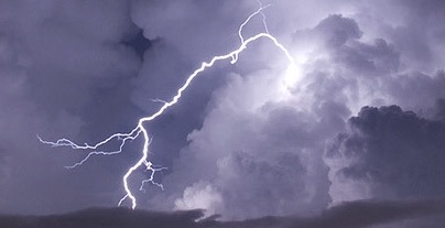
SOUTHEAST OHIO – The National Weather Service has placed the region including Meigs County under a Tornado Watch until 9 p.m. on April 14, 2019.
The Hazardous Weather Outlook is for portions of Southeast Ohio, and portions of West Virginia. On Sunday numerous severe storms are possible into the evening. The Storm Prediction Center has indicated there is an Enhanced Risk of severe weather for the entire region this afternoon and evening. Developing Sunday afternoon a line of thunderstorms will be moving through the region producing the possibility of severe weather including tornadoes. Damaging winds will be the primary severe weather threat, although hail stones are possible.
A Tornado Watch means to be prepared and that tornadoes are possible in and near the watch area. A Tornado Warning means a tornado has been sighted or indicated by weather radar.
What to do:
- Tornado Watch: Be Prepared! Review and discuss your emergency plans and check supplies and your safe room. Be ready to act quickly if a warning is issued or you suspect a tornado is approaching. Acting early helps to save lives! Watches are issued by the Storm Prediction Center for counties where tornadoes may occur. The watch area is typically large, covering numerous counties or even states.
- Tornado Warning: Take Action! There is imminent danger to life and property. Move to an interior room on the lowest floor of a sturdy building. Avoid windows. If in a mobile home, a vehicle, or outdoors, move to the closest substantial shelter and protect yourself from flying debris. Warnings are issued by your local forecast office. Warnings typically encompass a much smaller area (around the size of a city or small county) that may be impacted by a tornado identified by a forecaster on radar or by a trained spotter/law enforcement who is watching the storm.
- Tornado Aftermath: Assess and Repair! If a tornado has hit the area, you will need to start picking up the pieces. Gas and water lines may be damaged, personal property that has been destroyed will need to be assessed for insurance claims or salvageable items. Even if the tornado was not close to your property, flying debris could have caused damage to the windows or roof, in which case you would need to make repairs as soon as possible. Division Kangaroof for roof repair in Clarkesville is an example of a local repair company to call for a roof assessment.