A slow-moving Pacific storm will bring late-season rain and mountain snow to California before moving into the Southwest, providing modest but welcome rainfall while drought and wildfire concerns remain.
A Pacific storm is expected to move slowly toward California later this week before drifting inland over the weekend, delivering much-needed rain and a bit of high-elevation snow. While the storm is not the greatest of the rainy season, its extended duration will result in numerous days of precipitation in certain areas.
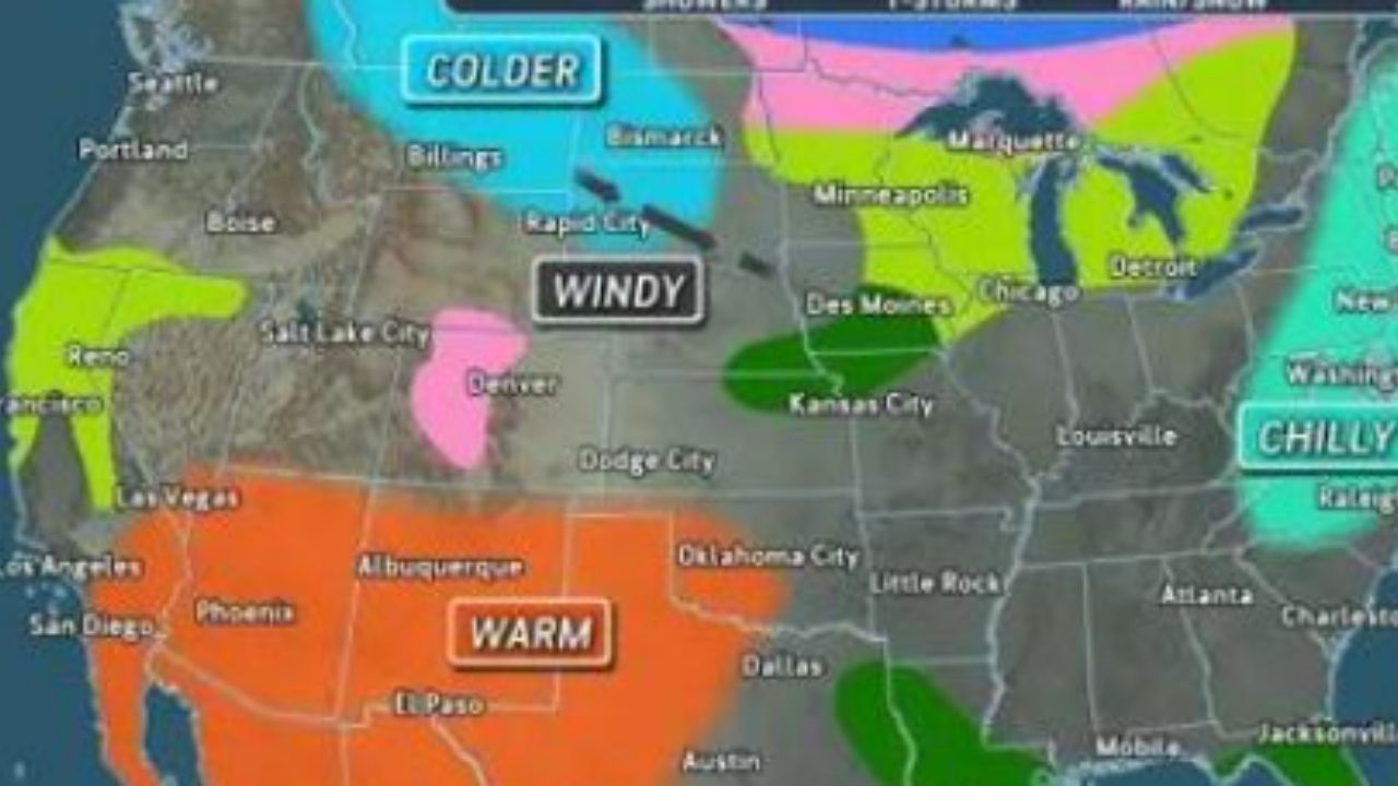
Dry weather will continue across much of the West until midweek, with a renewed warming trend in areas of the interior Southwest.
Wednesday’s highs are expected to be in the mid-90s F in Phoenix and the low 90s F in Las Vegas, with increased cloud cover from the approaching Pacific storm. Temperatures in Phoenix may still reach the high 90s on Friday, ahead of the storm.
A marine layer will keep temperatures constant around the California coast, including Los Angeles and San Diego, with highs in the 70s, though low clouds may linger into the afternoon until midweek.
The first showers from the Pacific storm will hit the Northern California coast Wednesday night and reach San Francisco on Thursday.
Showers will move into the Sacramento area later Thursday and eventually reach Los Angeles on Friday or Friday night. Showers may arrive in San Diego late Friday night, and patchy rain may reach Las Vegas or Phoenix Saturday.
Coachella attendees near Indio, California, should expect dry, breezy, and hot conditions on Friday, with sunlight and a high in the upper 80s. People should expect to get soaked on Saturday. Breezes might blow dust before rain falls. Sunday will be cooler and mostly dry, with a high in the lower 70s.
As the rainy season comes to an end in April and May, the chances of rain decrease. With significant dryness already in place east of California, each late-season storm takes on greater importance than the North American monsoon’s typically infrequent rainfall.
Rainfall will often range from a few tenths of an inch to one inch. Where thunderstorms form or mountains lend a push, heavier downpours might drop a few inches of rain. On March 31, a storm dropped just under a quarter-inch of rain in downtown Los Angeles. This storm has the potential to exceed that, resulting in the most rainfall since mid-February.
The chance of flash floods and mudslides is minimal with this storm, although the risk increases when downpours are concentrated in thunderstorms.
Given the premature drying of vegetation caused by last month’s record-breaking heat wave, any rain will temporarily alleviate wildfire concerns.
The storm’s delayed pace will result in numerous days of precipitation. Although the overall rainfall may be minimal, we anticipate the wet weather and cooler temperatures to persist for many days.
Snow showers, or rain combined with wet snow, will be limited to higher ridges and peaks in the Southwest during this storm.
After a break from later this weekend to early next week, a comparable storm may slowly creep onshore along the Pacific Coast later that week.


Leave a Reply