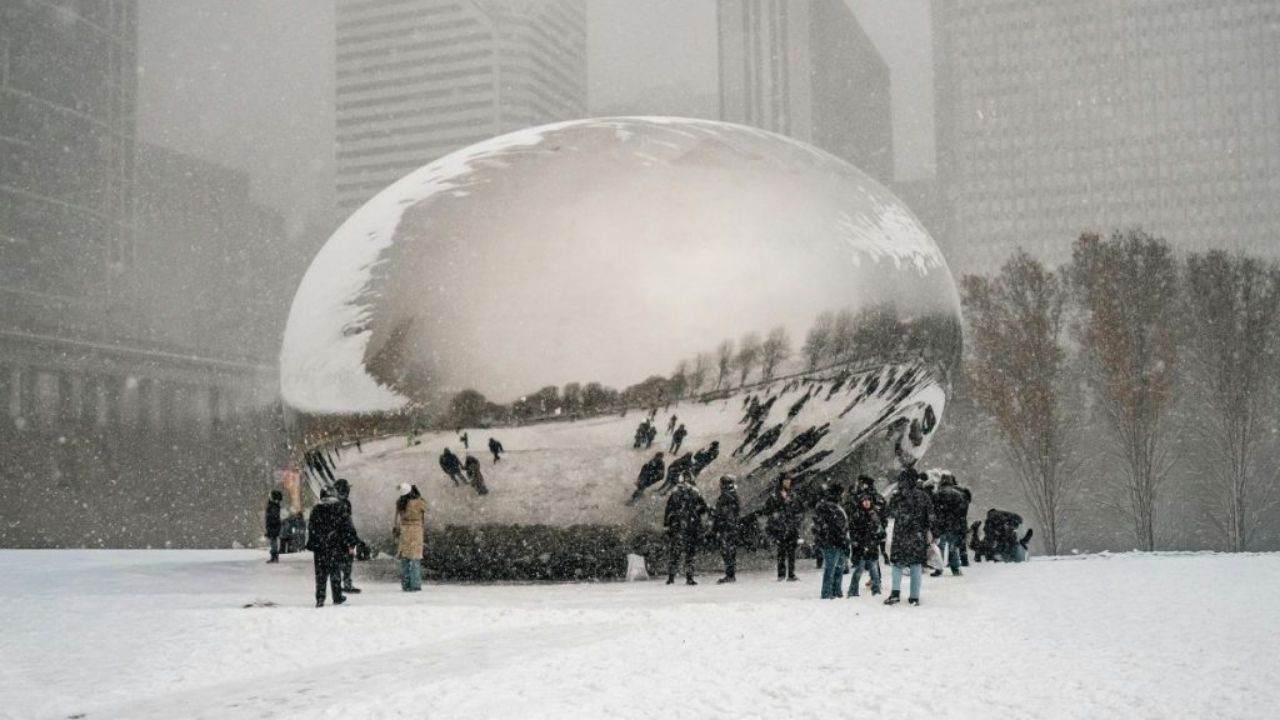
A quickly increasing winter storm caused the National Weather Service (NWS) to raise a Winter Weather Advisory to a Winter Storm Warning for Chicago and much of Cook County on Sunday, citing increased snowfall rates and hazardous travel conditions in northeastern Illinois.
According to the NWS Chicago office, the warning will continue in force until 4:00 p.m. CST, with heavy snow falling at times, particularly around Lake Michigan.
Forecasters predict an additional 2 to 5 inches of snowfall, with storm totals reaching 6 to 12 inches around the lakefront due to persistent lake-effect snow bands. During the most extreme occasions, snowfall rates could exceed one inch per hour.
“Travel will remain very hazardous into the early afternoon, especially in areas affected by lake-effect snow,” the National Weather Service in Chicago warned in a late-morning report.
The warning applies to Northern, Central, and Southern Cook County, encompassing Chicago, Evanston, Oak Park, Cicero, Schaumburg, and the neighboring suburbs. Northwestern sections of the county are predicted to receive lesser totals, typically 2 to 4 inches, although travel conditions may deteriorate fast owing to heavy snowfall and poor visibility.
According to the NWS Lincoln office, winter storm warnings are still in place across much of Illinois outside of the Chicago metropolitan region. Central and east-central Illinois could receive up to three inches of snow through the evening, with blowing and drifting snow particularly affecting rural roadways. Cities like Springfield, Champaign, Decatur, and Effingham are under active warnings until 6:00 p.m. CST. The storm system is also impacting neighboring states. The NWS Northern Indiana office anticipates 5 to 8 inches of snowfall in northern Indiana and northwest Ohio, with the highest amounts likely along and south of U.S. Route 24. Further south and east, the NWS Indianapolis office cautions that 6 to 10 inches of snow may fall in central and north-central Indiana, potentially impacting Monday morning commutes.
Transportation groups throughout the region are encouraging drivers to forgo unnecessary trips. Roads are predicted to remain snow-covered and treacherous, and visibility may be reduced significantly under heavier snow bands. The Illinois Department of Transportation recommends motorists to verify current conditions using its official travel information systems before leaving.
The National Weather Service continues to emphasize readiness. Drivers who must travel are encouraged to have emergency supplies such as food, drink, and a torch in case of delays or accidents. Officials also urge providing more travel time and keeping longer following distances.
Forecasters predict that circumstances will progressively improve later Sunday evening as snowfall decreases from west to east. However, prolonged snow and chilly temperatures may cause slick roads overnight. Residents are recommended to check official NWS updates as the storm progresses and to follow local authorities’ instructions throughout the region.


Leave a Reply