The National Weather Service (NWS) has issued an urgent winter weather warning for four counties in northern Arizona, predicting increasing snow and severe wind gusts beginning Monday night.
The Kaibab Plateau, Western and Eastern Mogollon Rim, and the White Mountains are still under a Winter Weather Advisory from 8 p.m. Monday to 5 p.m. MST Tuesday, according to the NWS office in Flagstaff.
The advisory applies to Flagstaff, Williams, Forest Lakes, Munds effectsPark, Jacob Lake, Heber, and Greer.
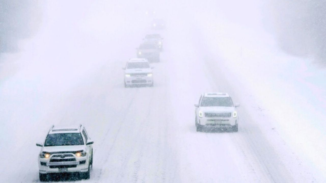
Forecasters predict total snow accumulations of up to 8 inches at higher elevations, with wind gusts of up to 50 mph. The combination of moderate to heavy snowfall and strong winds is likely to cause hazardous travel conditions, particularly during peak commute hours on Tuesday morning and evening.
“Roads, especially bridges and overpasses, will likely become slick and hazardous,” according to the advisory from the National Weather Service. Officials also warned that strong winds might cause tree branches to fall, further disrupting travel and potentially causing isolated power outages.
Snowfall amounts will vary depending on location. Flagstaff could receive 3 to 6 inches, while Forest Lakes and Jacob Lake may receive 4 to 6 inches. Williams and Munds Park are expected to receive between 2 and 4 inches. Lower accumulations are likely in Fredonia, Heber-Overgaard, and Pinetop-Lakeside, with trace amounts up to one inch possible. Show Low is expected to see little to no accumulation.
The dangerous circumstances are predicted to have a considerable impact on mountain highways and rural roads, particularly elevated parts of Interstate 40, State Route 87, and other rim-country links.
Officials advise drivers to slow down, allow additional time, and check road conditions before leaving. The Arizona 511 system provides motorists with up-to-date roadway information.
The winter storm striking northern Arizona is part of a larger weather pattern spreading over the Southwest. In adjacent Nevada, the National Weather Service in Las Vegas has issued a Winter Weather Advisory for Lincoln County over 5,000 feet. The alert is in effect from 1 p.m. Monday to 10 a.m. PST Tuesday, with 2 to 4 inches of snow forecast and wind gusts of up to 50 mph.
Snow levels in Nevada are expected to start around 7,000 feet Monday afternoon and fall to below 5,000 feet by Tuesday morning. Additional snowfall may occur in lower elevations on Tuesday night and Wednesday, highlighting the storm system’s dynamic nature.
The most substantial affects for Arizona residents are expected overnight Monday into Tuesday afternoon, when snowfall intensity and wind speeds are at their height. Residents should expect slick sidewalks, ice roads, and limited visibility during heavier snowfalls, according to the NWS.
As the storm approaches, officials underline the importance of being prepared and cautious. Travelers are advised to take emergency supplies such as blankets, water, and flashlights, especially when driving across high elevations.
The advisory will stay in effect until late Tuesday afternoon, and meteorologists will continue to watch the system for changes that may necessitate increased alerts.


Leave a Reply