
Texas heads the February 5-9 period with a clearly split temperature pattern, with warmer-than-normal weather settling across the Panhandle and western portions of the state, while north-central Texas and the Gulf Coast trend closer to seasonal averages. Despite the contrast, precipitation prospects remain restricted statewide, lowering the risk of snow or significant rain throughout this period.
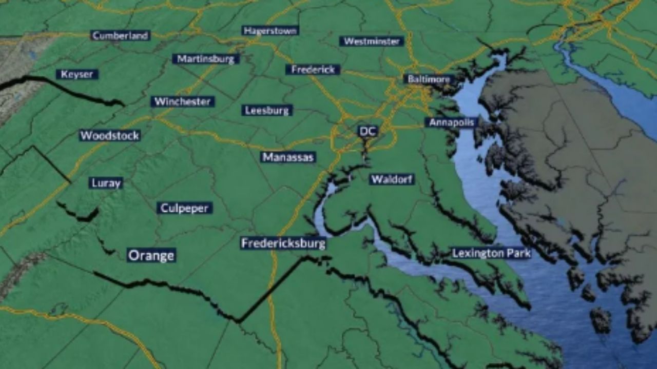
According to the National Weather Service and NOAA forecasts, the core of colder-than-average air stays east of Texas, extending from the Midwest to the Mid-Atlantic and along the I-95 corridor into the Southeast and Florida. This configuration allows milder air to dominate in western Texas and the Panhandle, while more seasonable air prevails across North Texas and the Gulf Coast.
Temperatures in Houston, Galveston, and the neighboring Gulf Coast areas are predicted to be around normal in early February, with cool mornings and moderate afternoons but little risk of frigid extremes. Further north, including the Dallas-Fort Worth area, readings should be near to average. Above-normal temperatures are forecast in Amarillo, Lubbock, and much of West Texas, providing a welcome relief from recent cold periods.
While no winter precipitation is forecast, the overall cold pattern follows previous weeks in which almost 100 temperature-related deaths have been reported in southern states, emphasizing the significance of weather vigilance even during quieter periods. Texans are reminded to be aware of changing weather, utilize heating sources responsibly when necessary, and keep attentive for any developments. The split temperature pattern is forecast to last throughout the time, with modest rain chances remaining statewide.


Leave a Reply