

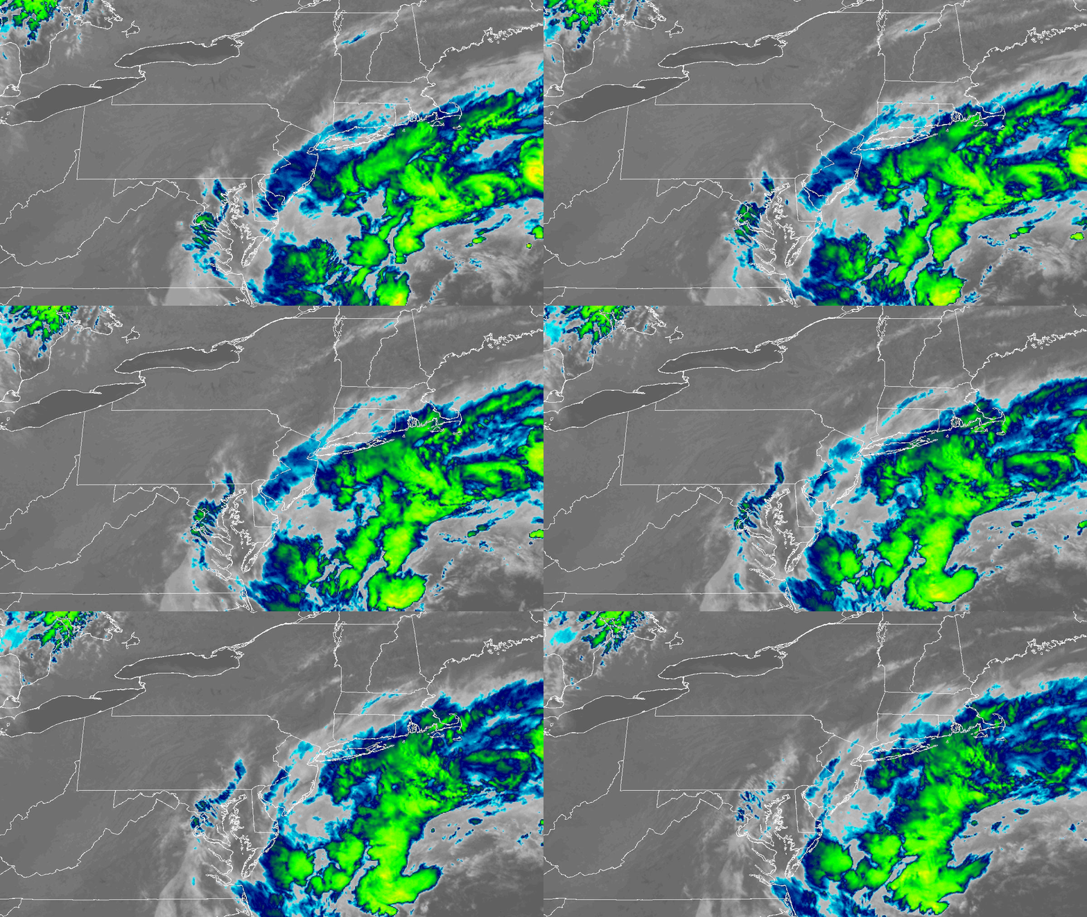
A rare September nor’easter will strengthen as it approaches the tri-state area, bringing wind gusts near 60 mph, coastal flooding, and 12-foot waves capable of eliminating entire sections of beach.
Strong winds began developing Thursday night, accompanied by choppy waters off Long Island and the Jersey Shore. These conditions continue, with gusts reaching near 60 mph by the afternoon, including areas within and around New York City.
Wind advisories
Winds intensify further Saturday, with gusts up to 60 mph anticipated. The Jersey Shore faces heightened risk, prompting a high wind warning for coastal Ocean County.
Tracking the flood threat
Breezy conditions result from a high-pressure ridge anchored to the north and an area of low pressure to the south. An easterly wind flows between these systems, creating a wind-tunnel effect that strengthens as the low-pressure system deepens by the weekend.
Forecast models from European and American sources now align on a similar track for the low, increasing certainty in projections.
Rain arrives Friday evening and continues intermittently through Saturday and Sunday. Most areas around the tri-state, including NYC, the Hudson Valley, and much of New Jersey and Connecticut (particularly inland), receive 1-2 inches of rain over the weekend.
Long Island, especially eastern Suffolk County, faces heavier rainfall, with totals of 3-4 inches possible. The rain spreads over time, limiting flash flooding concerns. Any flash flooding that occurs affects Long Island primarily.
Saturday marks the peak of the storm, when combined wind and high surf produce the greatest impact.
Churning seas along the entire East Coast elevate risks for coastal erosion and high-tide flooding. Coastal flooding intensifies during northeast winds, which push ocean water onshore. The high tides Friday evening, Saturday mid-morning, and Saturday evening present the greatest flood concerns.
Coastal flooding affects low-lying areas on Long Island and the Jersey Shore in typical vulnerable locations. Most coastal communities experience minor coastal flooding, while a few spots on Long Island and in Ocean County encounter moderate coastal flooding.
The vast majority of the tri-state faces a wet and windy weekend that disrupts early fall outdoor activities. Residents benefit from staying indoors, though concerns beyond discomfort remain minimal. The region remains gray and chilly, with afternoon temperatures in the 60s.
This nor’easter ranks as low-to-moderate in impact. The early fall timing eliminates snow from the forecast.
Nor’easters typically feature strong coastal lows during winter, delivering howling winds, blowing snow, and whiteout conditions that halt coastal activity. This weekend’s storm does not meet those criteria.
The storm does not develop into an extremely intense low-pressure system at its Saturday-into-Sunday peak. Winds moderate as a result.
Winds ease Sunday, and rain tapers off late Sunday into Monday. The low weakens and exits the region, yielding favorable weather for the following week. Highs reach the 70s with abundant sunshine.






Leave a Reply