COLUMBUS, Ohio — Storm chances will build midweek ahead of a more active weekend. Showers and thunderstorms are expected Wednesday and Thursday, with a risk of some becoming strong to severe. The likelihood of severe weather increases further on Saturday.
A Tornado Warning was issued for Licking County on Tuesday evening but expired at 9:45 p.m. Officials have not reported any immediate damage.
Wednesday
Watch for strong to severe thunderstorms across Northern Ohio on Wednesday afternoon. Quarter-sized hail and 60mph wind gusts are the main threats.
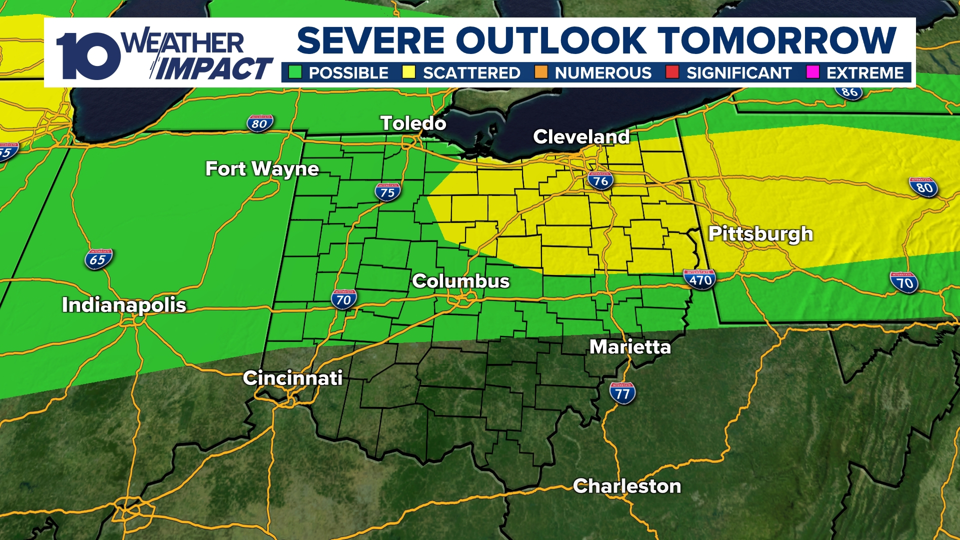
Credit: Chris Tomer
Strong to severe thunderstorms possible on Wednesday with hail and damaging wind
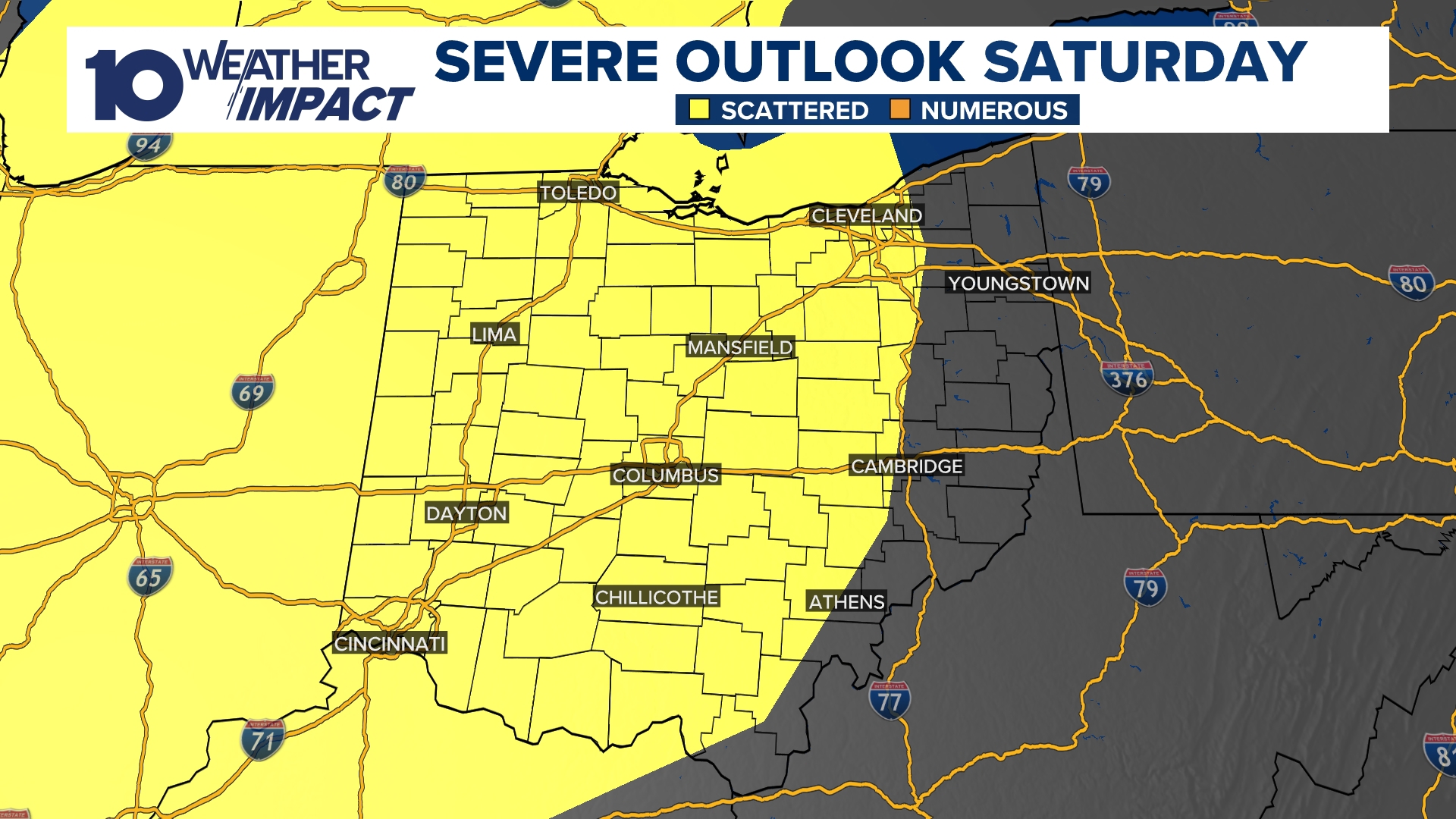
Saturday
A powerful storm system will take shape over the Great Plains in the coming days, triggering several rounds of severe weather from the Plains into the Midwest on Wednesday, Thursday, and Friday. By Friday, a cold front will push through, sparking additional storms across multiple states. Those storms are expected to move into Ohio by Saturday.
Credit: 10 Weather Impact
Rain and storms may develop Saturday morning, followed by a potentially stronger line of storms forming through the afternoon and evening. Damaging wind gusts pose the greatest threat, though storm development could also bring a risk of hail and even a tornado.
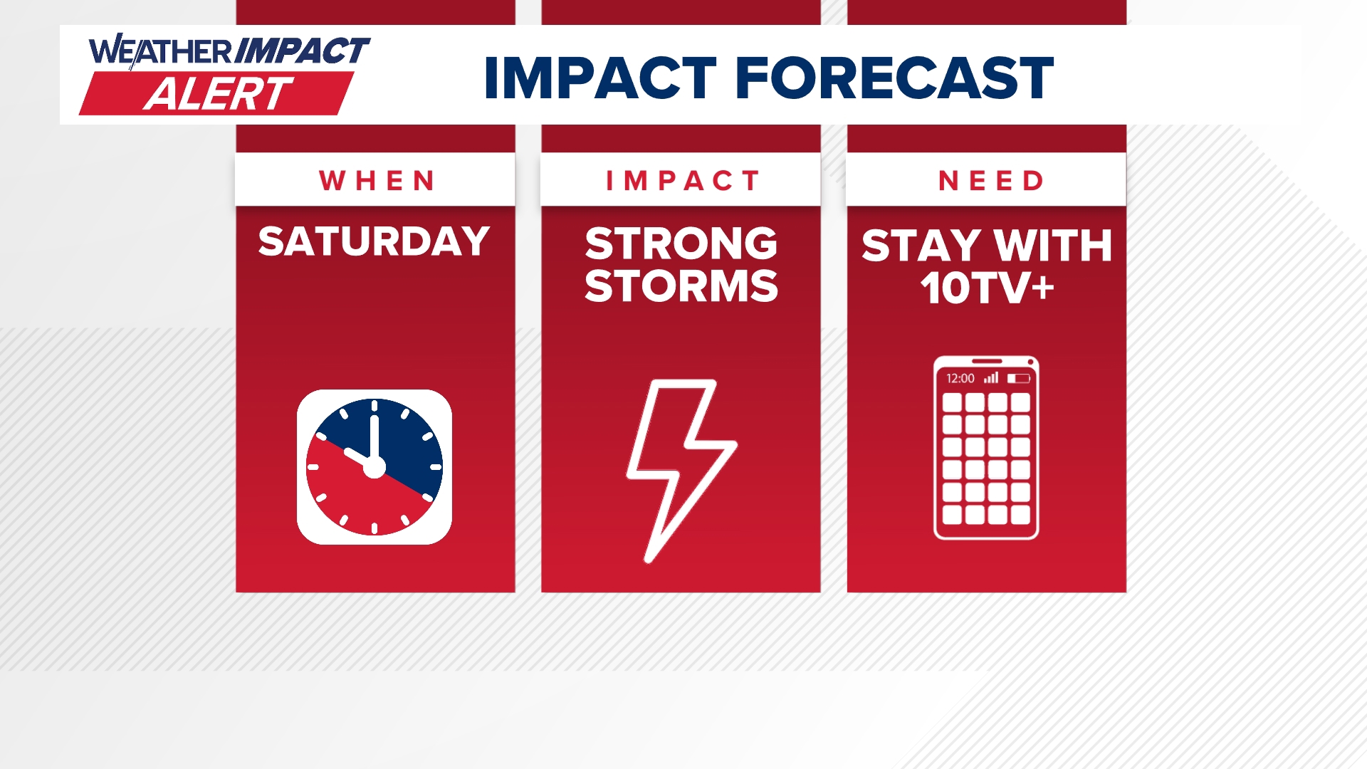
Credit: 10 Weather Impact


Leave a Reply